Trillium Learning Aerial Survey – Unmanned Aircraft Systems – Scientific Applications Course
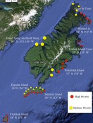
A World Bridge® Partners: NASA Ames Research Center – World Wind (Geospatial 4D Platform); NOAA -Tsunami Marine Debris Monitoring, Alaska Aerospace – Pacific Spaceport Complex Alaska; U.S. Coast Guard; UMass at Amherst and U.S. Fish & Wildlife Service – Invasive Species Identification, Disaster Resilience; Florida International University, TerraFly Program; Nanotechnology in Agriculture, Sea Water Level Rise and Environmental Biology Studies
The Trillium-developed Aerial Survey UAS Courses include training in all aspects of UAV (Unmanned Aerial Vehicle/drone) workflow operations, including:
1. Piloting, Safety, How UAV’s Work, Navigation and Mission Planning
2. Data Acquisition including High-definition Camera Image/Video Capture, Dual-operator Camera/Gimbal operation
3. Data Analysis including Orthomosaic Map Generation and Mapping/Geographic Information Systems (GIS)
4. Data Visualization including multilayer GIS mapping, 3D/4D Data Layers on NASA World Wind platform.
Three Aerial Survey UAS SA Courses begin with small training UAVs (Levels 1-4) and move up to more powerful and capable professional-level vehicles (Levels 5-7). Scientific applications where UAS will support real-time projects include those mentioned above. The UAS Scientific Applications Project provides students with a full-spectrum approach for development of Career Technical Skills in the fast-rising field of UAS flight, navigation and mission planning.
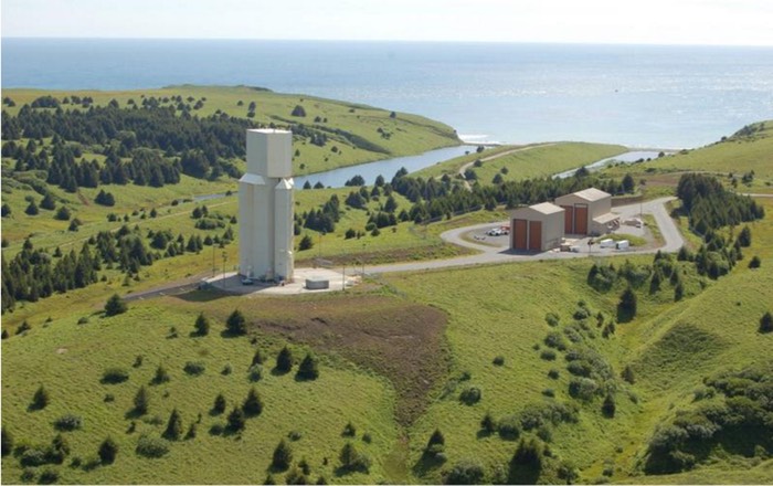
Alaska Aerospace – Kodiak Launch Complex: University of Alaska System’s FAA UAV Research Site partnered with Trillium Learning
Trillium Learning Partners
See summary of UAS Courses, and Aircraft Vehicles Levels 1-7
The Trillium-developed Aerial Survey UAS Courses include training in all aspects of UAV (Unmanned Aerial Vehicle/drone) operations, including How to Fly, Safety, How UAV’s Work, Navigation and Mission Planning, High-definition Camera Image Acquisition, Orthomosaic Map Generation and Mapping/Geographic Information Systems (GIS).
These projects will involve students and teachers to engage in developing real-world project research utilizing NASA Geospatial 4D software (World Wind) and Unmanned Aircraft Systems (UAS). Student teams will collaborate to develop comparison studies, acquire environmental and image data, then utilize data for informatics, and trends analysis.
Aerial Survey UAS SA: Three Courses, Levels 1-7
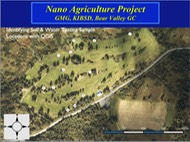
All UAS SA courses are based on real-time, real-world projects, including Tsunami Marine Debris Monitoring, Nanotechnology in Agriculture, Invasive Species Identification, Disaster Resilience, Construction Inspection, Environmental Impact Studies and future Smart City/Sustainable Earth programs.
UAS SA1
The first course – UAS SA1- is comprised of 5 Levels of aircraft, challenges, missions and curriculum content, including Navigation, Image/video data acquisition, Flight safety, Mission planning, Intro to GIS. Levels 1-4 are training levels up to beginning First Person View (FPV) components. Level 5 is entry-level professional with GPS and high-definition cameras and gimbal stabilization systems, software mission programming and includes full FPV.
UAS SA2
The second course includes continuing but advanced study from SA1, and utilizes UAVs from Levels 5-6 including low- to mid-professional level drones with FPV, goggles and 4K-resolution imagery/video capability. Workflow includes: 1. Flight Navigation and Mission Planning, 2. Data Acquisition, 3. Data Processing and Analysis, 4. Data Visualization including GIS media development and 4D Geospatial Data visualization.
UAS SA3 (under development)
The third course includes advanced applications from SA2 and utilizes Level 6 and 7 UAV’s along with highest-end photogrammetry from DSLR cameras, NDVI, special filter thermal cameras, and next generation, highest-end imagery acquisition with LIDAR (Laser-ranging) equipment. This course is under development.
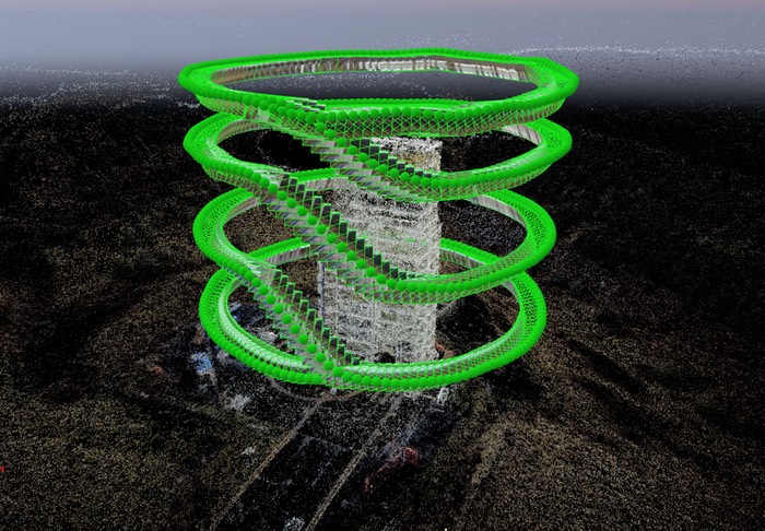
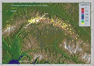
Kodiak Launch Complex 1 Point Cloud
- Resource Mapping and water encroachment/loss of seaside village land due to flooding and rising water levels
- Mapping and trends analysis of glaciers and snow/ice melting – continuous updating of effects of melting related to land loss
- Monitoring regrowth in areas devastated by events such as forest fires
- Forest fire mapping to follow and aid in fighting forest fires; regrowth of ground cover and vegetation over time
- Urban Planning/Demographics studies – show planning and building growth over time, effects on environmental resources, transportation
- Animal migration patterns, determining various species’ population densities, relationship to food sources and understanding ecological impact
- Plant diversity and density studies – development of image databases over time, to determine ecological balance, effects of pollution, etc.
- Utilization
of research tools for data acquisition and analysis including:
- NASA World Wind geospatial software for developing time-based water and snow/ice data image layers
- Unmanned Aerial Vehicle (UAV) technologies (drones equipped with sensors and cameras) for GPS directed mapping tools and image acquisition.
- Computer/laptop/tablet real-time data acquisition (Vernier, Intelesense) for environmental data acquisition (water/air temperature, flow, pH, salinity)
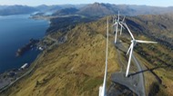
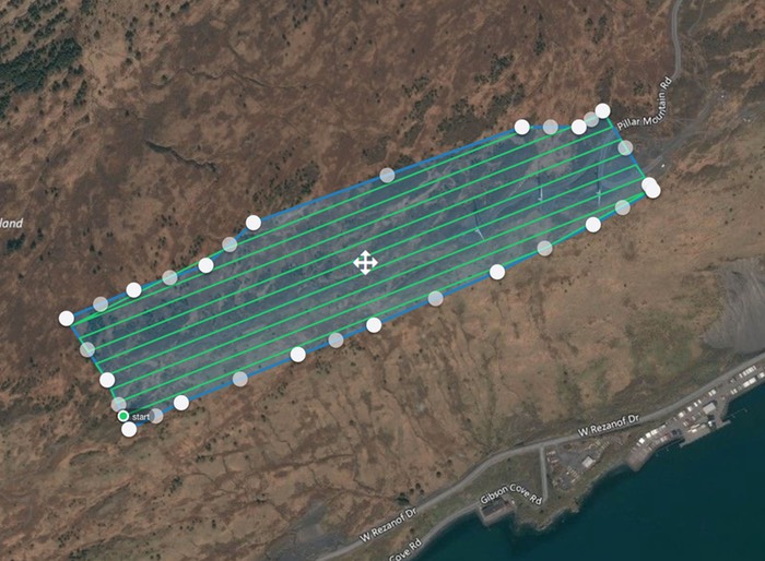
Kodiak Electric Association – Wind Turbine Farm Flight Plan
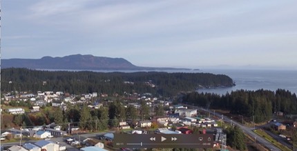
Panorama Movie – click image below to play movie; 2K resolution
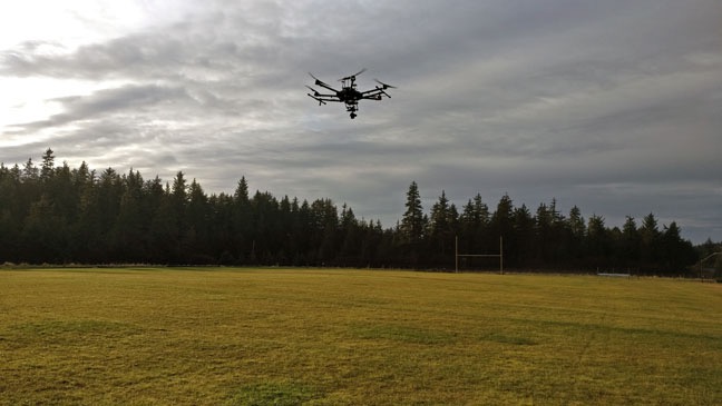
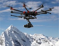
M600 from the Ground (click for full image)