
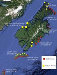
In cooperation with: Sherry Williams, Chair, Florida Exotic Pest Plants Council; Biologist and Park Ranger for the Seminole County Greenways and Natural Lands Division. Sherry is responsible for the invasives program on 10,000 acres of natural lands, passive parks, paved trails and active parks including prescribed fire monitoring. In addition, Sherry serves as the Steering Committee Chair for the Central Florida Cooperative Invasive Species Management Area (CISMA) and as Vice President for the Cuplet Fern Chapter of the Florida Native Plant Society.
Sherry identified the Econ River Wilderness Area, and Lake Jessup Wilderness Area as priority sites for high-definition UAS mapping. The first aerial mission was flown on Feb. 13, 2016 at the Econ River Wilderness Area.

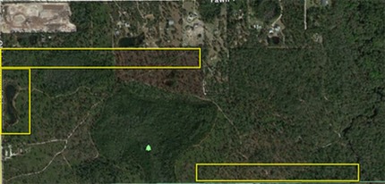
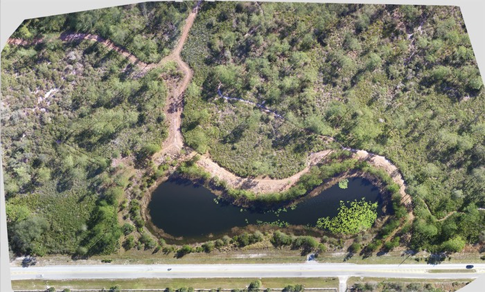
There are 3 areas of interest in this area as seen in the image below. The top area was not flown due to high variable winds at the time, and the lower area was not flown due to high-voltage lines immediately within/under the flight path. We will study these two areas and determine safe-to-fly launch and boundary locations. The second area was flown under ideal conditions, so a very high-density image course was programmed in order to deliver not only HD orthomosaic, but a 3D rendering of the area.
ConditionsThe flight covered approximately 11 acres, a 2.1 mile flight path, maximum speed of 11 mph. altitude of 165 ft. A total of 208 images were captured for the orthomosaic processing at a 2.2 cm/pixel resolution.
Environmental conditions: Full sun/no clouds, winds were variable at 5-15 mph with gusts from 18-20mph, 73 degrees F.
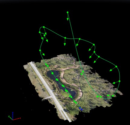
The next image shows the mission parameters. The blue circle represents the Homepoint, or launch location. The orange circles indicate flight boundaries. Straight lines indicate flight path transects.
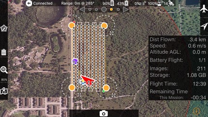
The small light-green dot in the SE corner represents the first waypoint and image capture, while the small red circle in the NW corner represents the last image capture.
Each dark-green circle represents an image capture location; each location is geotagged in the metadata, which is used later in creating the full orthomosaic.
The orthomosaic was processed from 208 geolocated images, (link to the image processing report). The orthomosaic is a 347 MB GeoTiff, and can be directly imported into GIS software. The image is 16,003 x 10,527 pixels (W=222 in. H=146 in.) and may be downloaded here or click the image below. Additionally, a compressed Stuffit (sitx) file contains the KML image tiles -uncompress the .sitx file and open the KML file with Google Earth or soon, NASA World Wind. If you prefer, a .zip, download is also available. The entire package of 208 actual-size images are compressed into one .sitx 810MB file and may be downloaded – please make these download requests to info@trilliumlearning.com.
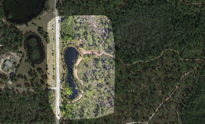
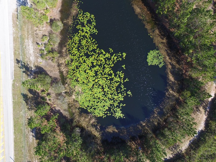
Econ Lake Area – QGIS Screenshot
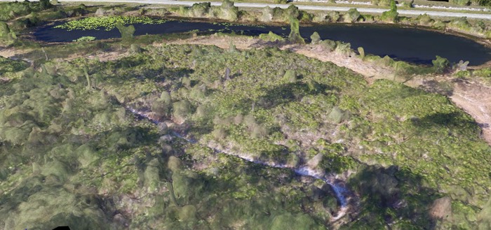
Due to the high amount of image overlap, a 3D image was also generated (images to follow). The following fly-through movie (mp4) was generated from the processed point cloud.The image below represents the flythrough path. (click here, or the image below to play the fly-through movie)
The point cloud is generated by locating all gps positions taken from the UAS which tags each image with latitude and longitude, then cross-references points in each image recognized in neighboring images. The following graphic shows the Econ point cloud. A median of 61,430 keypoints were generated for each image, and of these, 7,701 keypoints (per image) were matched with neighboring images.
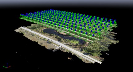
Each blue sphere represents an image capture location, and you can see the image thumbnail beneath the blue sphere which represents the projection down to the actual surface map. The cross and side-referencing of these images (if dense enough) allows for the 3D object to be manipulated on 3 axes.
The following image was taken from the 3D object map.
An actual size part of a single image – these are clear images (56×42 in.) useful for species identification. (Click here or on picture to download)
Actual size image