Multi-image Orthogrammetry Maps and Video

![]()
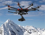
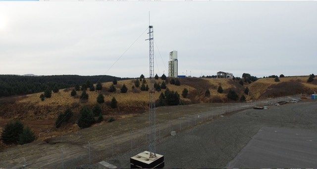
Trillium Learning’s A World Bridge™ current UAV research activities at Alaska Aerospace – Pacific Spaceport Complex Alaska (PSCA) in Kodiak, Alaska are part of the University of Alaska system’s FAA UAV research program. Activities include (not limited to, nor in particular order):
-Test geofencing for altitudes (30m, 61m, 91m, 122m)
Fly the UAV at four different altitudes, testing the geofencing software at each, for FAA guidelines.
-Test line of sight to determine maximum visual distance
Fly the UAV in a straight line until line of sight is nearly compromised, record the distance, return to Homepoint.
-Test geofencing multiple distances up until established distance from line of sight test
Test the geofencing at four different distances, with the max distance being the result of the line of sight test.
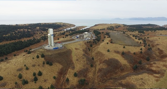
-Test Point of Interest procedures at PSCA water tower
Set a waypoint at the center of the water tank, set the predetermined altitude and distance from tank, and test Point of Interest procedures.
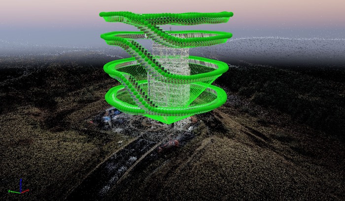
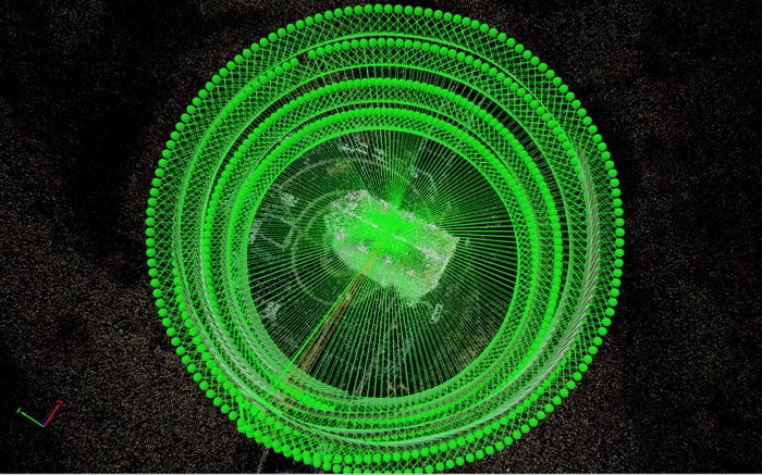
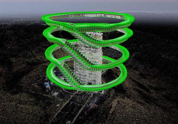
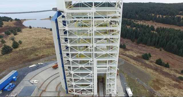
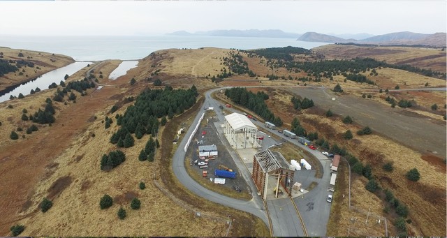
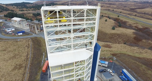
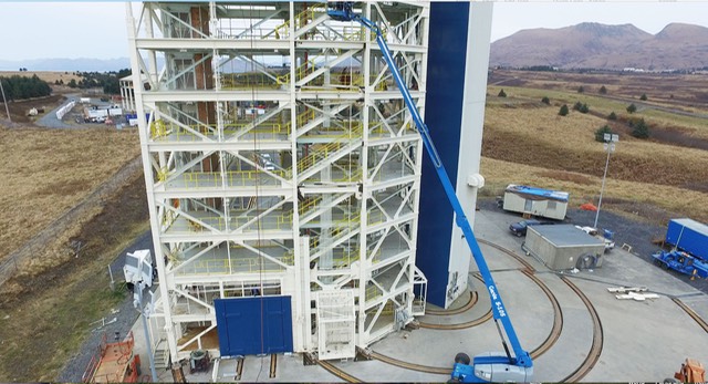
-Test Point of Interest procedures at Launch Complex 1
Set waypoint at center of Launchpad Tower, set predetermined altitude and distance, record POI video.
-Mapping Part 1- Pick area for high definition mapping (orthomosaic)
Take pictures of the predetermined area to be put in Pix4D
-Mapping Part 2- Waypoint mapping
Set waypoints around an area, then test waypoint mapping.
-Identify five areas (1/4 mile run each) for disaster simulation (4k video)
Fly UAV for 1/4 mile run in each of the five predetermined areas to simulate the disaster resilience mapping
-Test Follow Me function through disaster resilience simulation
Set the altitude and distance from controller, then test Follow Me function, which has the UAV follow the controller.
Data Visualization and Media from Test (movies at bottom of page)
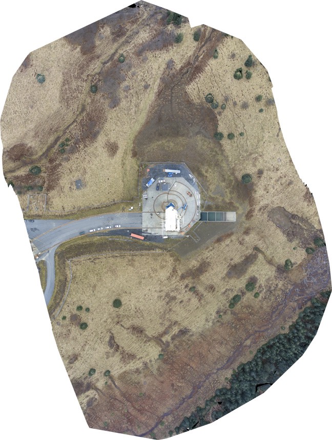
Launch Complex 1 Orthomosaic: Send email to info@trilliumlearning.com for download PSCA_LP1_Map.tif
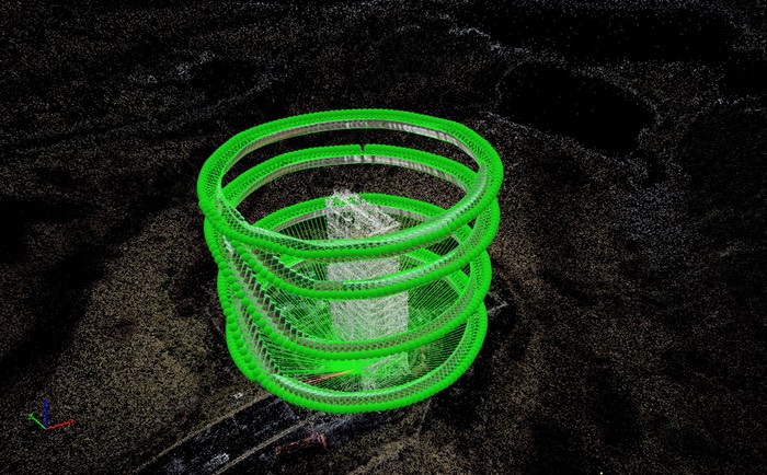
Kodiak Launch Pad 1 Point Cloud1
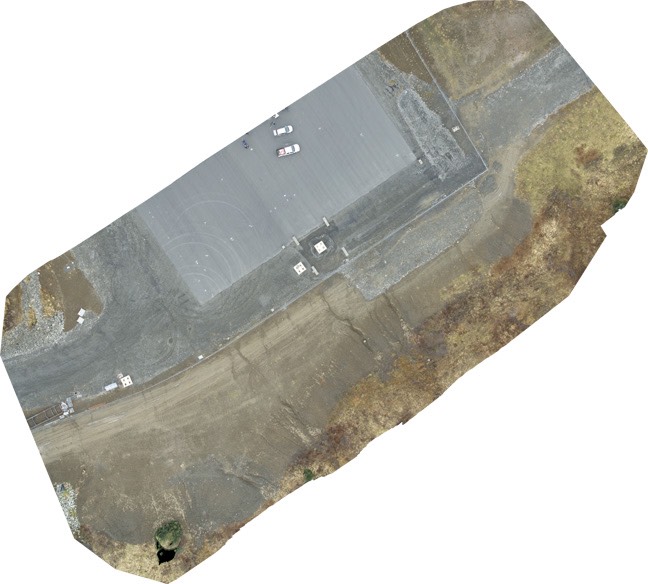
CubeSat Launch Map: Send email to info@trilliumlearning.com for download: PSCA_CubeSat_Map.tif
Kodiak Launch Pad 1 Point Cloud2
Kodiak Launch Pad 1 Point Cloud3
Kodiak Launch Pad 1 Point Cloud4
PSCA Movies (Request access to movie downloads at info@trilliumlearning.com)
1_Slow_LP1_Rise.mp4
2_PSCA_Pano.mp4
3_Upper_LP1_InspectionOrbit.mp4
4_Full_Inspection_Orbits.mp4
5_CloseUpRise.mp4
6_FromRocketStorage.mp4
7_LP1_fromRocketStorage.mp4