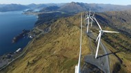


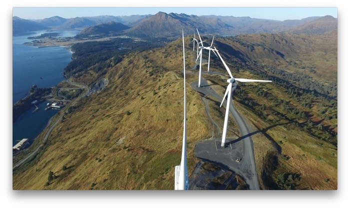
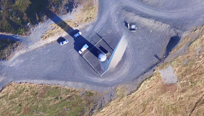
The A World Bridge™ Program at Kodiak Island Borough School District began performing aerial inspections for the Kodiak Electric Association on Sept. 28, 2016. Students from the Unmanned Aircraft Systems – Scientific Applications, and NASA CitySmart projects participated in the mission planning, preflight checks and image/video capture. Data currently being processed includes imagery from the KEA Wind Turbines located on Pillar Mountain.
The following movie represents a small portion of the video obtained by the aircraft’s 4K camera.
Click on the image below to play the movie.
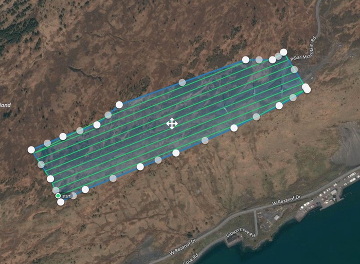
The image below represents the waypoint map programmed into the UAV’s computer for autonomous flight, and designed to capture 215 high-resolution images as the aircraft follows the transects. This part of the mission resulted in the image analysis and development of an orthomosaic – georeferenced map of the current KEA Wind Turbine farm.
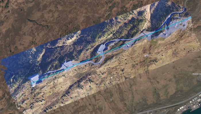
Resulting orthomosaic georeferenced map superimposed on satellite imagery.
Orthomosaic GeoTIFF Screenshot
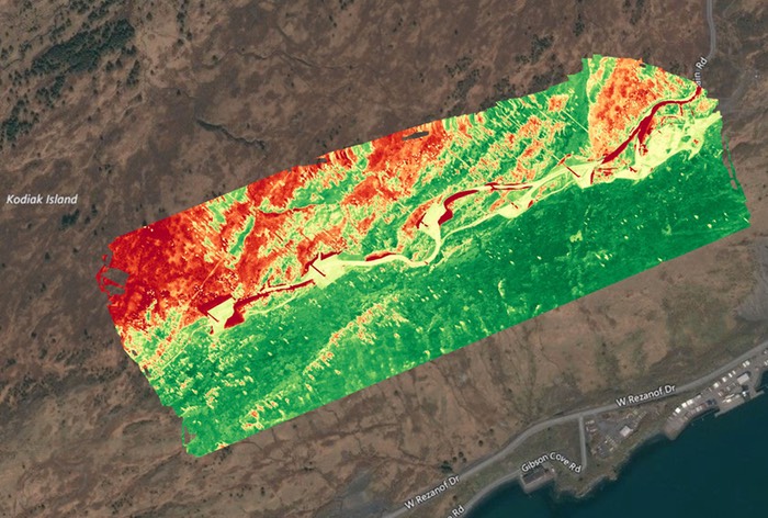
Vegetation Index
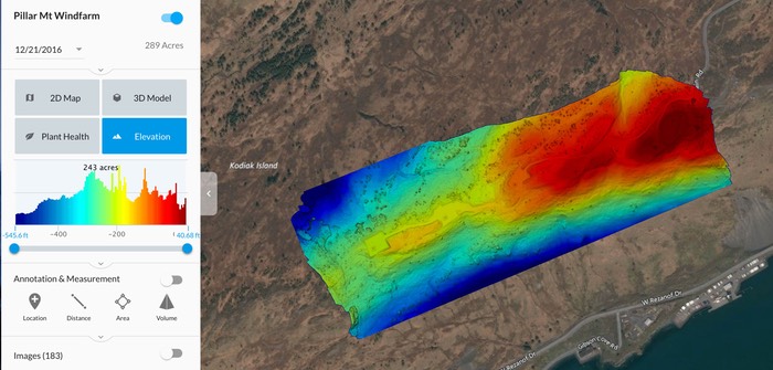
Elevation Model
Examples of inspection images taken from wind turbines
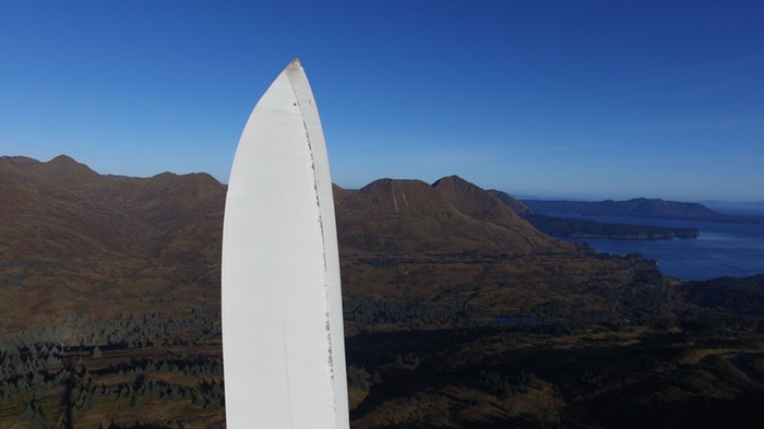
Blade Tip
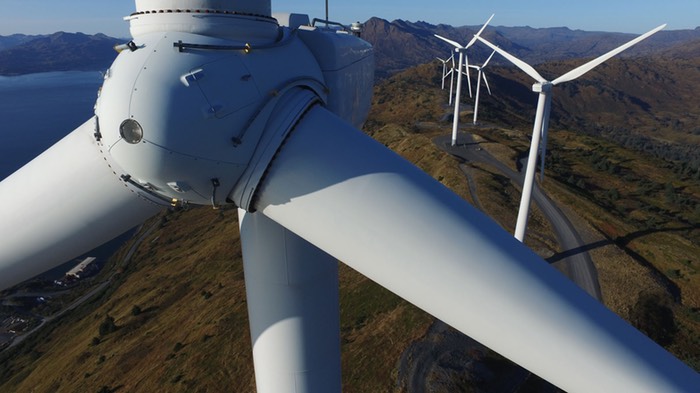
Wind Turbine Engine
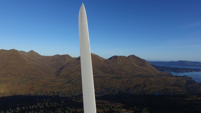
Blade Edge

Blade Tip Degradation
Orthomosaic – 5cm/pixel, converted to .jpg: Notice that generator and blades were blurred due to turning to face wind, so the composite mosaic image does not represent static wind turbine image.

Orthomosaic – 5cm/pixel, converted to .jpg: Notice that generator and blades were blurred due to turning to face wind, so the composite mosaic image does not represent static wind turbine image.
Contour Mapping
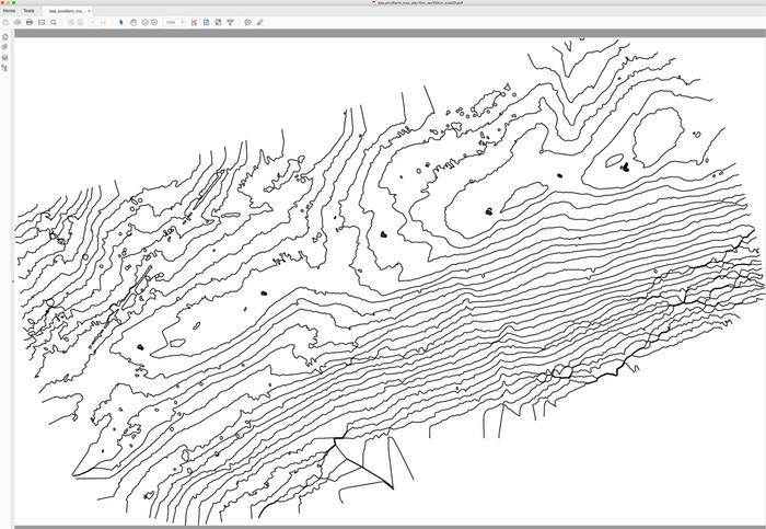
Contour Mapping: PDF Export
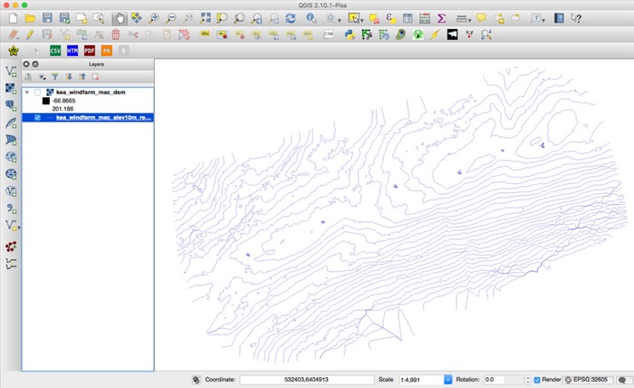
Contour Mapping: GIS Export (Shapefile)
Contour Downloads
DBF: kea_windfarm_mac_elev10m_res100cm_size20.dbf
DXF: kea_windfarm_mac_elev10m_res100cm_size20.dxf
PDF: kea_windfarm_mac_elev10m_res100cm_size20.pdf
PRJ: kea_windfarm_mac_elev10m_res100cm_size20.prj